
Rivers of Living Water: Submerged Forests in Yucatán's Springs
On the Yucatán Peninsula, rainwater seeps through limestone caves until it reaches the sea, forming subterranean estuaries where roots, algae, and endemic fish create submerged forests few people ever see.
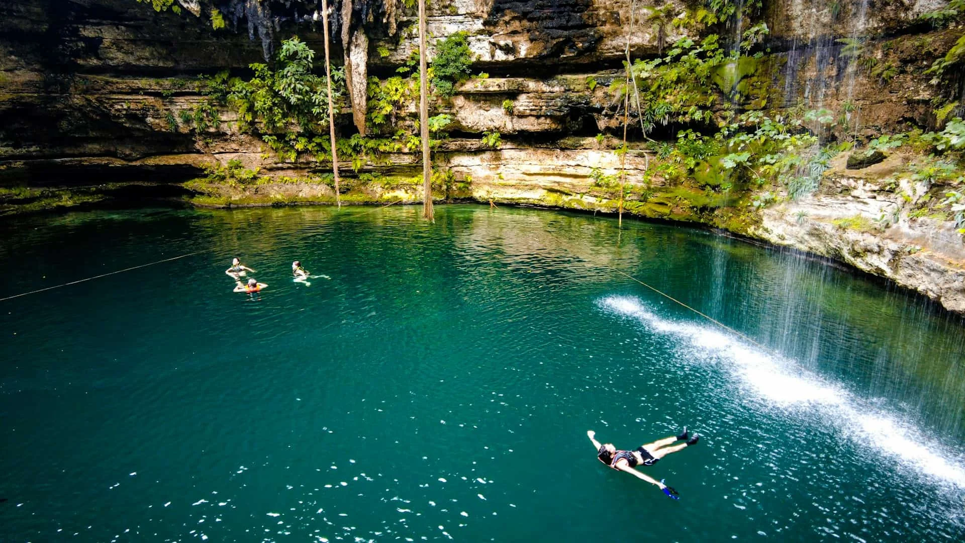
From the shore, the sea looks like an unbroken surface. Dive along the coast of the Yucatán Peninsula, near the mouth of a submarine cenote or a line of coastal springs, and the boundary between land and ocean begins to blur: shafts of light pierce rock, columns of fresh water rise through salt water, and forests of roots hang in the blue.
The Yucatán Peninsula is a karst platform of almost two million square kilometres made of porous limestone. It has no surface rivers. Rainwater seeps inland and flows through a subterranean network of caves, galleries, and cavities, a labyrinth dissolved through rock. When that water reaches the coast, it often discharges directly into the sea through sandy or rocky substrate, forming subterranean estuaries where fresh and salt water mix in transition zones you never see from the shore.
The karst as architect
Until recently, most coastal ecosystem models treated land-sea water exchange as a surface process: rivers, runoff, rain. Studies of subterranean estuaries have shown that a considerable share of fresh water discharge into the oceans happens beneath the seabed. In karst systems like that of the Yucatán, where the permeability of limestone lets water flow with little resistance, these subterranean estuaries act as hidden gateways between the continental aquifer and the coastal zone.¹
There, waters with different salinity, temperature, and chemistry create gradients that sustain microorganisms, fish, and invertebrates adapted to conditions that shift with tide, season, and rainfall. Water does more than seep through rock. It supports a full ecosystem functioning in twilight.
Fresh water that feeds the sea
One of the main functions of this submarine groundwater discharge is the transport of nutrients. For decades it was assumed that coasts received most of their nitrogen and phosphorus from rivers and atmospheric inputs. Recent research shows that submarine groundwater discharge adds a significant amount to coastal nutrient budgets, supplying nitrogen, phosphorus and dissolved carbon that fuel the productivity of plankton, algae and near-shore seagrass beds.²
Hydrogeologists call this a “river of living water”: an invisible yet quantifiable flow that emerges from rock and nourishes marine life without crossing the surface. In the Yucatán, where karst lithology favours these discharges, submarine springs are part of the coast’s metabolism.
The submerged forest
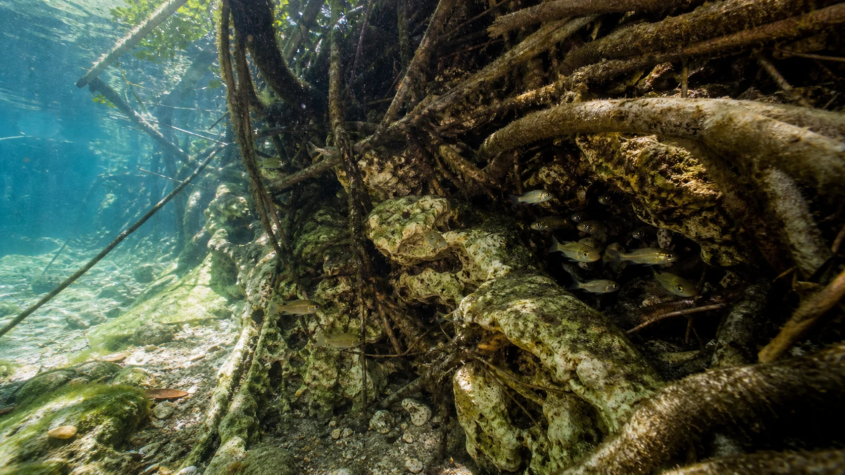
Dive into one of these discharge points and the landscape gives this article its name. Between the limestone and the water column, the roots of coastal vegetation, and in some cases the remains of submerged trunks, form upside-down forests. Filamentous algae and diatom communities grow on them; among the branches, juvenile shrimp, copepods, and small molluscs find shelter from the swell and larger predators.
These submerged forests act as natural nurseries. The light entering from a cenote’s surface, or filtering through karst fissures, creates a distinctive light spectrum: deep blues, faint greens, shadows that shift with the hour. The substrate, the constant temperature of groundwater and the intermediate salinity generate microhabitats that are reproduced neither in fresh water rivers nor in open coral reefs.
Fish that only exist here
The structure of these habitats shapes the fish community. Studies of fish assemblages in Yucatán cenotes and springs show that refuge availability, fissures, roots, and rock cavities, together with water chemistry, determines which species persist and which do not.³ Some populations are isolated in closed systems; others use the springs as movement corridors between the aquifer and the coast.
Endemism is the rule. A fish caught in one cenote may have no equivalent in another system just a few kilometres away, because the geological history of the karst has fragmented habitats into isolated cells. Instead of one large aquarium, the region holds a network of natural mini-aquariums connected by tunnels that only water can traverse.
Fragility of an invisible sanctuary
The Sian Ka’an Biosphere Reserve, declared a UNESCO World Heritage Site, protects part of this system of cenotes, lagoons, and coastal wetlands.⁴ Conserving a subterranean sanctuary requires attention to what happens inland: water extraction wells that lower the water table, hotel developments that contaminate the aquifer with wastewater, and mass tourism that alters the chemistry of open cenotes.⁵
If the underground flow diminishes or changes in chemical composition, the marine discharge shifts. So does the web of life that depends on those nutrients and that water mix. The hidden flow sustains the visible coast.
And in the aquarium?
An aquarist cannot replicate a karst aquifer in a tank, but they can learn from its logic. A planted aquarium with emergent roots, a hypogeal zone with limestone rock, or a section where water circulates through porous substrates can echo the spirit of these submerged forests. The karst teaches a quiet lesson: beauty often lives in circulation, microscopic refuges, and the long patience with which water dissolves rock into sanctuary.
The next time you look at an aquarium with submerged roots and small fish hiding among them, ask yourself: are we building an ecosystem, or decorating a tank? The difference lies in whether we can make flow, refuge, and silent chemistry work with the coherence of a living cenote.
Sources
- Törnqvist et al., “Subterranean estuaries reveal nutrient cycling in coastal karst systems”, Nature Communications 11, 5187 (2020). DOI: 10.1038/s41467-020-18524-3. [Primary; high reliability]
- Santos et al., “The role of submarine groundwater discharge in coastal nutrient budgets”, Nature Geoscience 14, 585–593 (2021). DOI: 10.1038/s41561-021-00788-5. [Primary; high reliability]
- Carrillo et al., “Fish assemblages in Yucatán cenotes: endemism and habitat structure”, Hydrobiologia 839, 121–135 (2019). DOI: 10.1007/s10750-019-03943-2. [Primary; medium reliability; specific cenote data may require in-situ verification]
- UNESCO World Heritage Centre, “Sian Ka’an Biosphere Reserve and subterranean freshwater systems”. https://whc.unesco.org/en/list/1351/ [Secondary; high institutional reliability]
- World Wildlife Fund, “Cenotes of Yucatán: overview of freshwater ecosystems and conservation status”. https://www.worldwildlife.org/places/yucatan-peninsula [Secondary; medium reliability; general descriptive data]
Methodological note: descriptions of subterranean estuaries and nutrient cycling are based on the articles by Törnqvist et al. (Nature Communications) and Santos et al. (Nature Geoscience). The interpretation of “rivers of living water” as a metaphor for submarine groundwater discharge is an editorial condensation of the scientific term. Fish assemblage data come from Carrillo et al. (Hydrobiologia).
Topics
Newsletter
A weekly reading to see the aquatic world with clearer judgment.
Receive short, carefully edited reflections on aquatic life, ethical aquarium keeping, and applied science.
Subscribe